Bridge River - Yalakom Valley ( 4.5 ha or 11.2 acres )


- Size (acres)
- 4.5 ha / 11.2 acres
Description
4.5 ha ( 11.2 acres ) property near the old settlement of Moha on the Yalakom Valley Road about 31 km ( 19 miles ) northwest of the Municipality of Lillooet.
The property has approximately 250 m ( 820 feet ) frontage on the Yalakom River and 400 m ( 1/4 mile ) frontage on the Yalakom Road. It is located near the confluence of the Bridge and Yalakom Rivers in the Squamish-Lillooet Regional District. The zoning is Rural Resource 5 which permits, among others things, the building of one family dwelling.
The Moha area has year round sunshine and a mild winter climate. The property has views of the snow-capped Shulaps and Mission mountains and of the Camelsfoot mountains. The property is 800 m ( ½ mile ) from Fred Antoine Provincial Park.
Lillooet is a 4 hours drive from the City of Vancouver, 2 hours from the City of Kamloops, and 2 hours from the Resort Municipality of Whistler.
Location of the property: ( 50° 52' 26.8" North and 122° 10' 35.9" West ) or ( 50.874120, -122.176648 )
Property Identification Number ( PID ): 003-158-012
Year 2023 property taxes: $ 1006
Elevation ( above sea level ) of the property: From 480 m to 580 m ( from 1575 feet to 1900 feet )
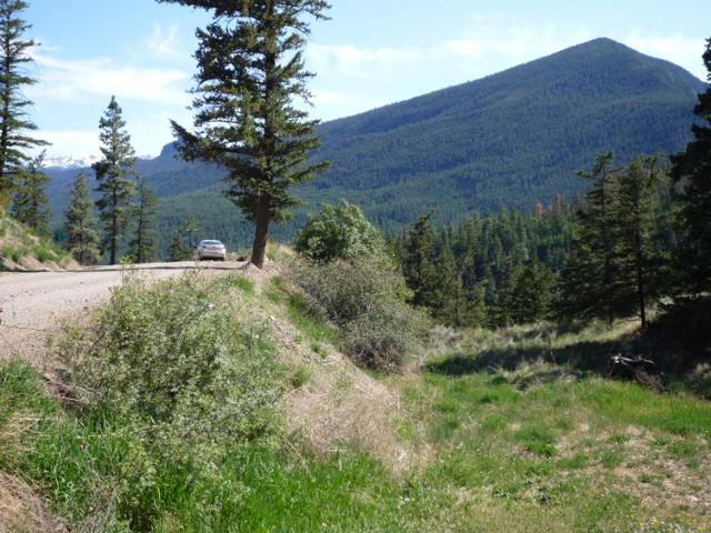
Image 1: On the Yalakom Road at the north end of the property viewing southeast towards the Mission mountains at 2440 m ( 8000 ft ).
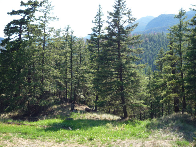
Image 2: At the north end of the property viewing southwest towards the Shulaps mountains at 2560 m ( 8400 ft ).
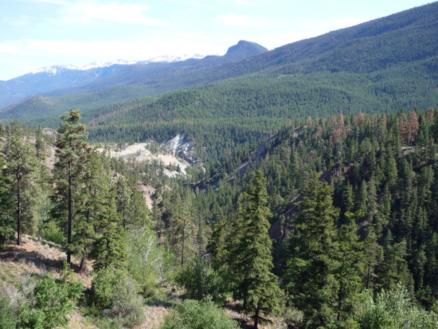
Image 3: At the upper center of the property viewing southeast towards the Mission mountains at 2440 m ( 8000 ft).
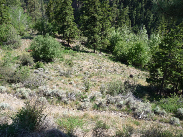
Image 4: The upper part of the property.
Image 5: At the confluence of the Bridge and Yalakom Rivers where the Bridge River Road ( Highway 40 ) crosses the Yalakom River.
Image 6: At the intersection of the Bridge River Road ( Highway 40 ) and the Yalakom Road.
Image 7: Survey plan of the property which is coloured in yellow.
Image 8: The survey plan in image 7 rotated 90 degrees clockwise.
Image 9: Reference Plan of the property in green and yellow colour. A dwelling and other buildings are allowed only in the area coloured in green.
Information on Moha..............................................................http://en.wikipedia.org/wiki/Moha,_British_Columbia
Information on the Bridge River Valley..................................http://www.bridgerivervalley.ca/
Information on Lillooet...........................................................https://visitlillooet.ca/
Information on how to get to Moha:.......................................https://www.rome2rio.com/map/Seattle/Moha-BC-Canada
Information on the Bridge River Valley and Moha.................http://bcadventure.com/murphys/gold/river.htm
Information on Fred Antoine Provincial Park.........................http://bcparks.ca/explore/parkpgs/fred_antoine/
Satellite view of the property:
https://www.bing.com/maps?ty=18&q=50.874%2C+-122.1766&ppois=50.87411885058594_-122.1766505444336_50.874%2C+-122.1766_%7E&cp=50.874445%7E-122.276459&v=2&sV=1&FORM=MIRE&lvl=11.0&style=a